

Key Takeaways
- A physical road atlas works without cell service, battery charge, or a data plan.
- GPS apps offer real-time traffic and turn-by-turn guidance that paper maps cannot replicate.
- Paper atlases never suffer from software glitches, map update failures, or server outages.
- Digital navigation can route drivers down roads that are impassable for certain vehicle types.
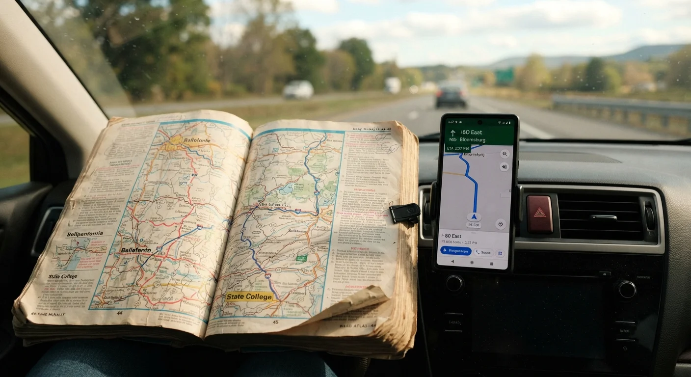
- Carrying both tools together costs little but significantly reduces navigation risk on long trips.
Works without cell signal or battery power
A paper atlas functions in dead zones, tunnels, and remote regions where smartphones lose connectivity entirely. It also works when a phone battery dies mid-route.
Never affected by software bugs or outages
GPS apps can crash, fail after updates, or become unusable if a mapping service goes offline. A printed atlas has no such dependencies.
Builds broader geographic awareness
Reading a regional overview helps drivers understand how cities, highways, and terrain connect - context that turn-by-turn prompts strip away.
Useful backup when GPS routes seem wrong
Navigation apps occasionally direct drivers down roads unsuitable for their vehicle type. A quick atlas check can catch these errors before they become a problem.
No real-time traffic or road closure data
A printed atlas cannot reflect accidents, construction, or detours that occurred after its publication date. Drivers must gather that information from other sources.
Requires manual interpretation while driving
Consulting a paper map safely means pulling over, which adds time and is impractical when a quick reroute is needed.
Maps go out of date over time
New roads, renumbered highways, and changed interchange configurations may not appear in an older atlas, creating potential for navigation errors.
No turn-by-turn guidance in unfamiliar cities
In dense urban environments with complex one-way systems and frequent turns, step-by-step GPS prompts are far safer than interpreting a paper grid while moving.
Our Verdict
A physical road atlas is not a replacement for GPS, and GPS is not a replacement for a paper atlas. Each fills gaps the other leaves open. Drivers who rely exclusively on one tool accept a blind spot they could easily close.
Any driver who regularly travels through rural areas, remote terrain, or regions with unreliable cell coverage will get the most value from keeping an atlas in the car alongside digital navigation.
Why This Question Still Matters
Smartphone navigation has become so default that many drivers haven't unfolded a paper map in years. That's understandable - GPS apps handle the cognitive load of routing, recalculate instantly, and warn about slowdowns ahead. But the assumption that digital navigation has made paper maps obsolete deserves a harder look.
The Federal Highway Administration estimates that roughly 30% of U.S. road miles are in rural areas where cellular coverage can be thin or nonexistent. When a navigation app loses signal on a remote stretch of highway, a driver who has never cross-referenced a paper map can find themselves genuinely lost. This isn't a hypothetical edge case - it's a predictable gap.
The debate is less about nostalgia and more about preparedness. Treating it like a pure either/or decision misses the point, much the way choosing between digital and in-store research each has its own strengths and blind spots.
The Case for Keeping a Paper Atlas
A road atlas requires no power, no signal, and no account login. It cannot be remotely disabled, corrupted by a software update, or rendered useless by a dead phone battery. These aren't minor conveniences - they're reliability characteristics that no digital tool can currently match.
Works without cell signal or battery power
A paper atlas functions in dead zones, tunnels, and remote regions where smartphones lose connectivity entirely. It also works when a phone battery dies mid-route.
Never affected by software bugs or outages
GPS apps can crash, fail after updates, or become unusable if a mapping service goes offline. A printed atlas has no such dependencies.
Builds broader geographic awareness
Reading a regional overview helps drivers understand how cities, highways, and terrain connect - context that turn-by-turn prompts strip away.
Useful backup when GPS routes seem wrong
Navigation apps occasionally direct drivers down roads unsuitable for their vehicle type. A quick atlas check can catch these errors before they become a problem.
There's also a spatial awareness argument. Research in cognitive science suggests that reading physical maps builds a more holistic understanding of geography than following turn-by-turn prompts, which can encourage passive navigation. Drivers who understand the broader layout of a region tend to improvise more confidently when a road is closed or a route changes unexpectedly.
Where GPS Has the Clear Edge
Paper maps cannot update themselves. A road atlas printed several years ago may not reflect new interchanges, construction detours, or changed speed limits. GPS apps pull live data - traffic conditions, road closures, even fuel prices - that a static printed page simply cannot carry.
No real-time traffic or road closure data
A printed atlas cannot reflect accidents, construction, or detours that occurred after its publication date. Drivers must gather that information from other sources.
Requires manual interpretation while driving
Consulting a paper map safely means pulling over, which adds time and is impractical when a quick reroute is needed.
Maps go out of date over time
New roads, renumbered highways, and changed interchange configurations may not appear in an older atlas, creating potential for navigation errors.
No turn-by-turn guidance in unfamiliar cities
In dense urban environments with complex one-way systems and frequent turns, step-by-step GPS prompts are far safer than interpreting a paper grid while moving.
Offline Maps Are a Middle Ground
Most major navigation apps allow users to download regional maps for offline use, which addresses the signal-loss problem without requiring a paper atlas. However, offline maps still depend on device battery life and can become outdated if not refreshed. They are a useful complement to - not a substitute for - the zero-dependency reliability of a printed atlas.
Real-time rerouting is arguably GPS's strongest feature. If an accident blocks a highway, a navigation app can redirect a driver within seconds. A paper atlas requires the driver to pull over, assess the map manually, and reason out an alternative - workable, but slower and less precise.
Practical Guidance for Everyday Drivers
The most useful framing is complementary rather than competitive. A road atlas stored in a vehicle costs little, takes up minimal space, and serves as genuine insurance against digital failure. A few practical habits help:
- Before a long road trip: Trace your general route on the atlas so you understand the major corridors, even if you rely on GPS during the drive.
- In rural or low-signal areas: Download offline maps in your navigation app as a backup, and keep the atlas accessible rather than buried in the trunk.
- When GPS routes feel wrong: Cross-check with the atlas. Apps occasionally route large vehicles down roads with low clearances or suggest unpaved paths not suited to standard cars.
~30%
U.S. road miles in rural areas
The Federal Highway Administration estimates roughly 30% of U.S. road miles are rural, where cellular coverage is often inconsistent or absent.
1 in 4
Drivers report GPS routing errors
Consumer surveys have consistently found a significant share of drivers have been directed down incorrect, closed, or unsuitable roads by navigation apps.
Neither tool is foolproof. The driver who treats GPS as infallible and the driver who refuses to adopt digital navigation both accept unnecessary limitations. The practical choice is to carry both and know when each earns its keep.